Your Trail is Waiting
GLTL Planning
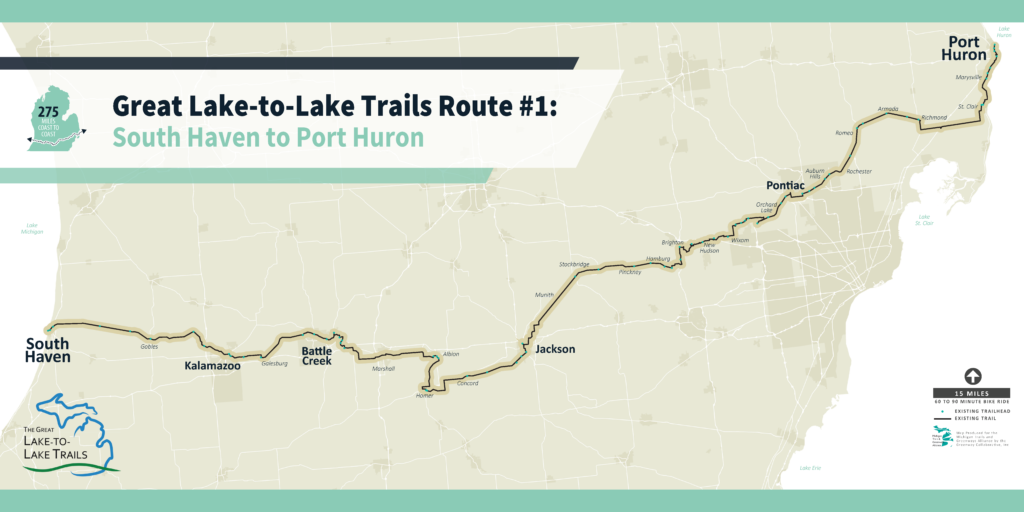
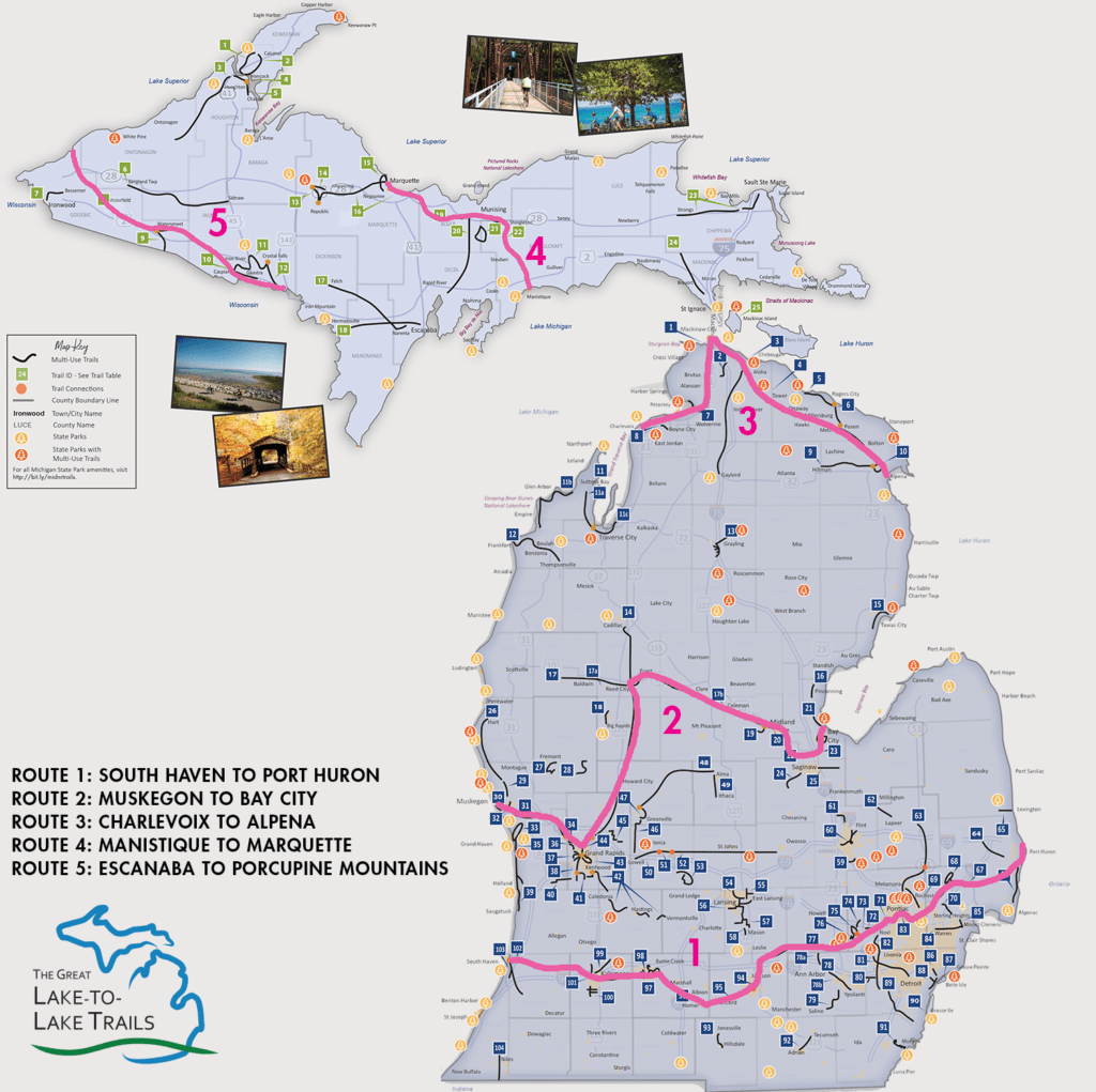
Stretching 275 miles from South Haven to Port Huron, Route 1 was mostly built on remnants of the original Michigan Air Line Railroad. Built-in 1883, the Michigan Air Line was one of Michigan’s first major railroads, running from Port Huron to Niles, Michigan. When most of the rail corridor was abandoned in 1975, several sections were acquired by the Michigan Departments of Transportation or Natural Resources and other county and local governments.
Today, this major stretch of the Great Lake-to-Lake Trails Route 1 run from Richmond (Macomb Orchard Trail) to Concord (Falling Waters Trail) near Jackson. From the west, Route 1 follows the Kal-Haven Trail State Park on the railbed of the former Kalamazoo & South Haven Railroad from the Lake Michigan shoreline to Kalamazoo. It then continues east on the Kalamazoo River Valley Trail, the Battle Creek Linear Park, and the Calhoun County Trailway.